csv2dat (deprecated)
What is it?
csv2dat is a free server-side web app, available after registering by e-mail at solutop@gmail.com. Once a *.csv file has been downloaded from the field applications that record GNSS data, it often has to be turned into a *.dat file so that it can be handled by Pregeo, the software of the Italian Land Registry (recent versions — June 2024).
csv2dat lets you:
- upload a file in *.csv format (see the bottom of the page for the correct layout)
- choose the master from the list of points held in the *.csv file
- produce a Pregeo-compatible field book in *.dat format with the variance and covariance matrices
- download it to be imported into Pregeo (updated to version 10.6.4)
- restart the app to use it again
Note
Lines 0, 9 and 6 cannot be edited and take random values. They are descriptive lines and have no effect on the computation of the field book, so they are filled in with standard random parameters, which lets the output file be imported into Pregeo without errors.
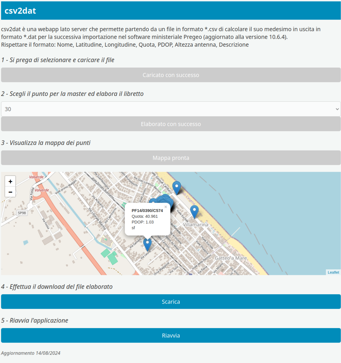
Fig.1 The application screen
Warning
The following layout has to be used, without a header and with the comma as the decimal separator, since anything else is rejected straight away on import:
- Point name (whole numbers only)
- Latitude (decimal degrees — dd)
- Longitude (decimal degrees — dd)
- Height (ellipsoidal, in metres)
- PDOP (a number, whole or decimal)
- Antenna height above the ground (in metres)
- Description (alphanumeric)
Here you can download an example file
Custom development
On request, other bespoke functions can be developed to improve the user interface, and new features can be added